Find Your Trail
The TART Trails network currently consists of multi-use trails in Grand Traverse and Leelanau counties as well as a cross-town bike route.
We acknowledge that all of the trails that make up the TART Trails network, now and in the future, exist on the ancestral lands of the Anishinaabe people who are today represented by the nations of the Grand Traverse Band of Ottawa and Chippewa Indians and the Little Traverse Bay Bands of Odawa Indians.
Acme Connector | Nakwema Trailway
The 2 mile Acme Connector connects the TART Trail and Acme, providing safe access to businesses, existing trails, and recreation opportunities. The trail connects the current TART Trail terminus at Bunker Hill Road to the
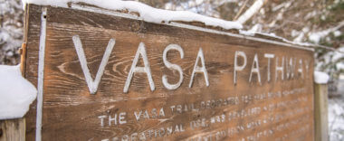
Vasa Pathway
Located on state forest land, the Vasa Pathway features a series of loops (3K, 5K, 10K, 25K) that offer users a variety of challenges from easy to difficult. Cross-country skiers, runners, hikers, mountain bikers, walkers,
Sleeping Bear Heritage Trail
The Sleeping Bear Heritage Trail is a non-motorized trail that showcases destinations within the Sleeping Bear Dunes National Lakeshore and the two Lakeshore towns of Glen Arbor and Empire. Currently the trail is 20 miles
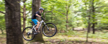
Vasa Skillz Loop
The Vasa Skillz Building Loop, built in partnership with NMMBA, is designed specifically for kids and adults new to mountain biking to hone their skills, while still hopefully staying upright. Two one-mile, single-track loops have
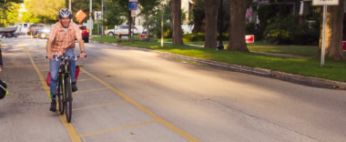
TART in Town
The TART in Town includes several point-to-point bike routes in downtown Traverse City. Parking Parking available along the trail. See map. Map PDF of TART in Town Map here.
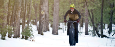
Winter Sports Single Track
The 15K Winter Sports Singletrack is groomed by the Northern Michigan Mountain Bike Association (NMMBA) from December through March. Winter trail access will be the same as summer access at the existing single-track DNR trail on Supply Rd.
Mall Trail
The nearly 2-mile long Mall Trail parallels US-31 from 14th St to South Airport Rd near the Grand Traverse Mall. The Mall Trail connects downtown Traverse City residents with many commercial businesses and restaurants. The
Three Mile Trail
Enjoy this 2-mile long trail that runs along Three Mile Road from the Traverse City State Park beach on US 31 to South Airport Road. Parking Parking can be found at corner of Parsons and
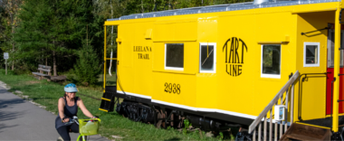
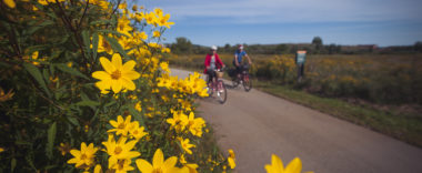
Leelanau Trail
The 17-mile Leelanau Trail provides a paved off-road connection between Traverse City and Suttons Bay. Running through the last of Leelanau County’s former railroad corridors, the Leelanau Trail features picturesque forests, farms, vineyards, lakes and
TART
The MDOT reconstruction of Grandview Parkway is underway. MDOT has many different phases of the project with non-motorized detours changing regularly. This detour map is our suggested bike/ped route from March through May. There may
Buffalo Ridge Trail
The Buffalo Ridge Trail is currently an almost 1.5 mile trail connecting The Village at Grand Traverse Commons to Traverse City West Middle School and the YMCA, passing by the TBA-ISD main office and conference center,

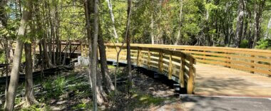
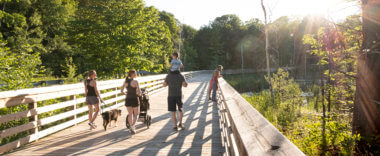
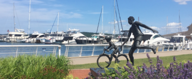
Boardman Lake Loop Trail
The 4-mile Boardman Lake Loop Trail is a trail that wraps around Boardman Lake, just south of downtown Traverse City. The northern portion of the trail offers an urban setting with commercial access. The east
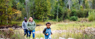
Boardman/Ottaway River Trail
The 24 miles of the Boardman/Ottaway River Trail is complete and provides 7 miles of newly constructed single-track trail connecting Mayfield Pond Park to the North Country Trail. Additionally, we are thrilled to have recently